
“At the northeast corner of this valley, the river suddenly turns from east to north, flows in this course a few miles between immense walls of sandstone, then turns again to the eastward, and holds this course to the mouth of the San Miguel, crossing on its way two sharp ridges and a transverse valley. After being joined by the San Miguel, this erratic stream seems to lose its desire to do strange and unexpected things.”
-Albert Charles Peale, Ninth Annual Report of the Geological and Geographical Survey of the Territories, 1877

I came out of Moab in a rented, black Nissan Sentra bound for the Rocky Mountains. I headed south out of town and passed Moab Rim Arch and the Hole ‘N’ The Rock – the last vestiges of the red, desert-solitaire landscapes of that place before cutting east on Utah state highway 46. The road was empty all the way up to La Sal, a one-horse village named by Spanish colonists who thought the snow-dusted mountains looked covered in salt. In La Sal, a general store and a US post office stand side-by-side in red brick overseen by a flagpole flying the stars and stripes along with the black POW/MIA flag. Later on, 46 drops down into a valley following La Sal Creek, curving closely alongside the stream, which was lined at this time of year with golden cottonwood trees with their thick, gnarled trunks spreading down to the water line in search of autumn hydration.
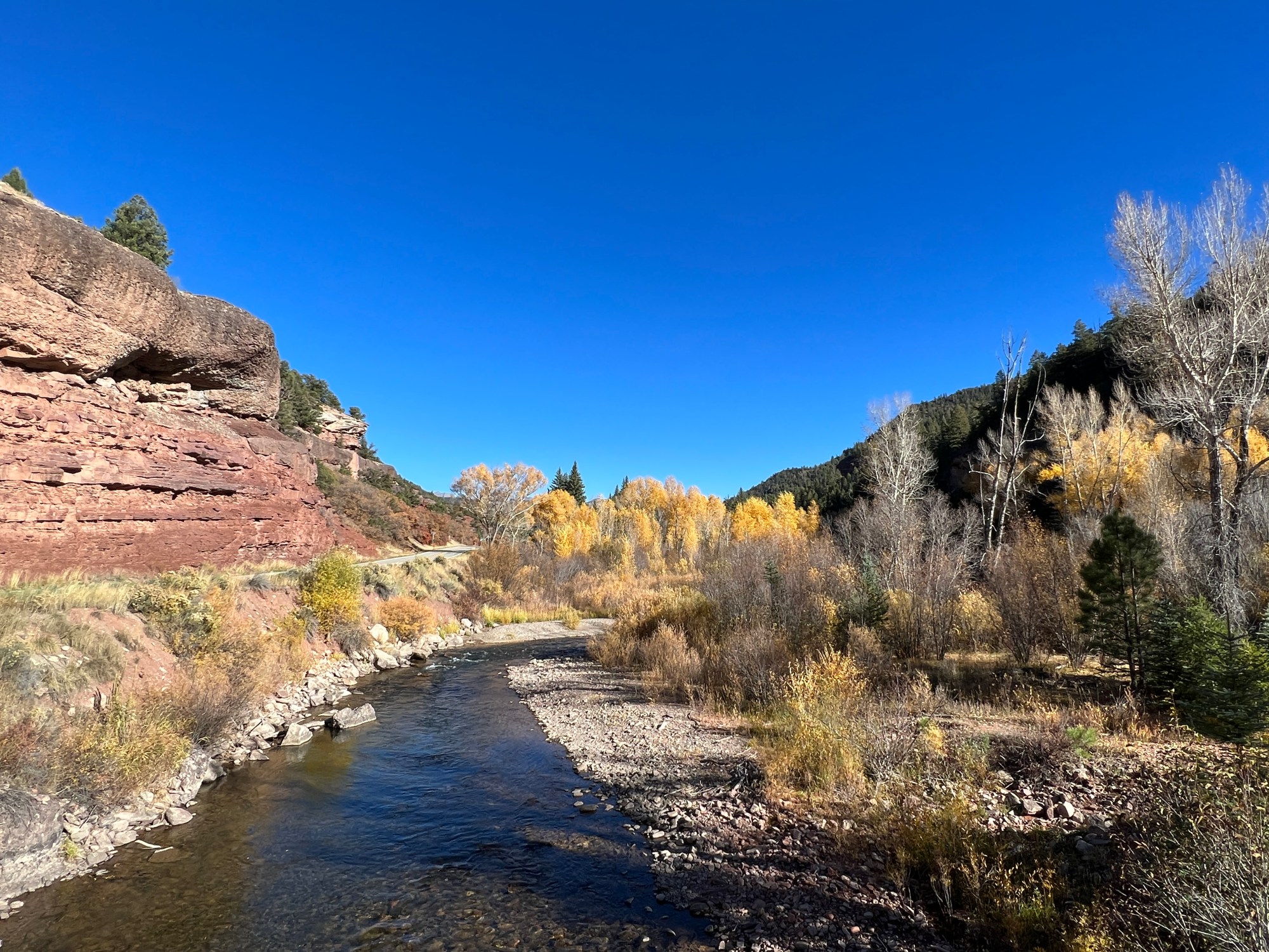
When I reached the state line, I got out at the ‘Welcome to Colorful Colorado’ sign and snapped a picture, then stood on a small bridge and watched the creek bubble by. Only a few cars passed and all else I heard was the fluttering of cottonwood leaves, which also sounded like rushing water.
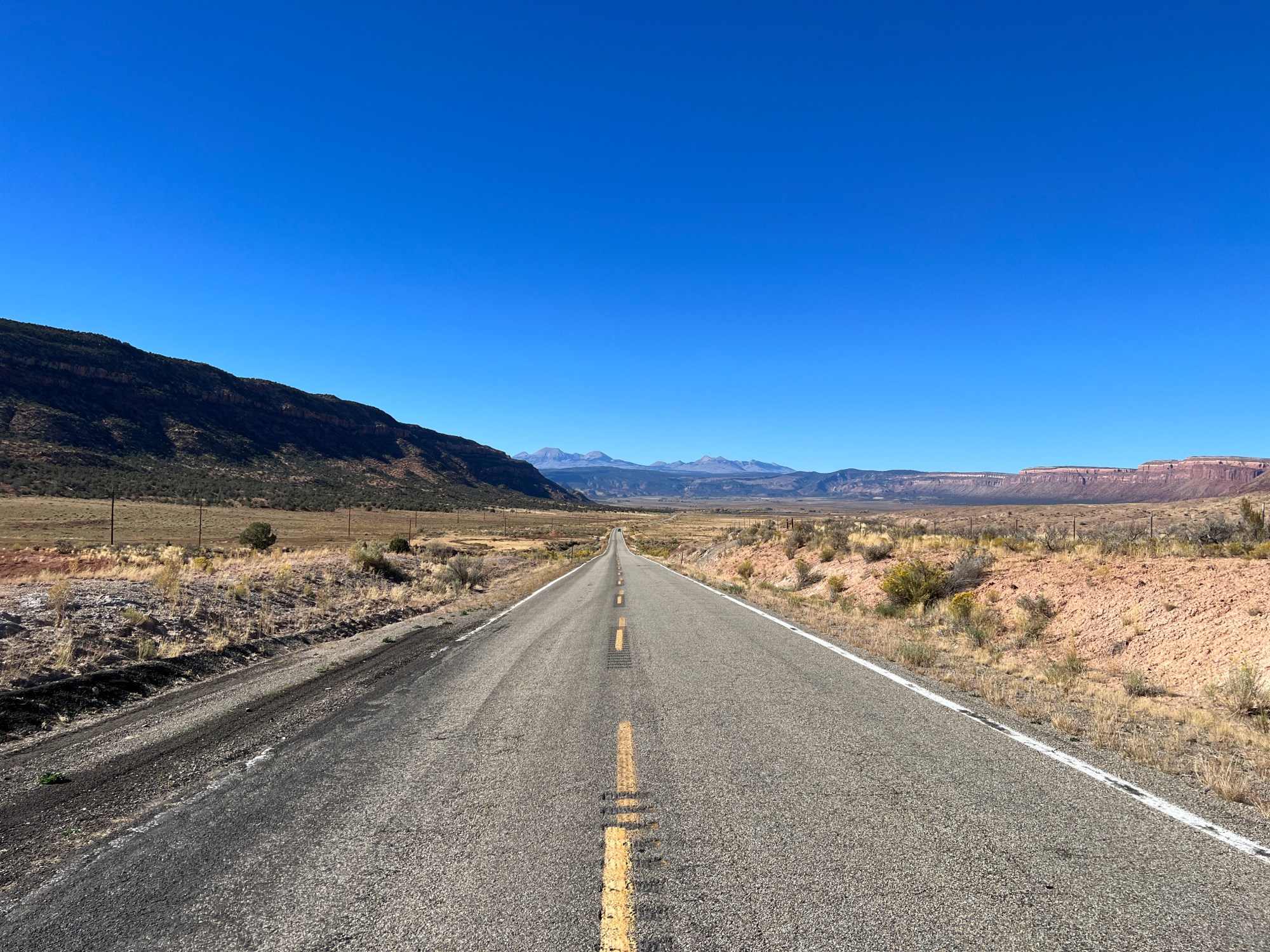
Here, the road turns into Colorado state road 90, so I followed it as it wound up away from the creek and north along a dry mesa-side dotted with dark green junipers. It kept climbing and finally crested at a curve where the view opened up to the right and suddenly the whole world was visible for hundreds of miles.
I stopped the car again along a wide portion of shoulder where gravel was hemmed in by a line of concrete barriers. Beyond them, the hillside dropped swiftly and dramatically and I could see the road switching back down into the valley further on. Nearest me was a small, low-rise forest of round junipers stretching along sagebrush and gramma-grass-covered hillsides with soil the colour of rust peeking out in between them.
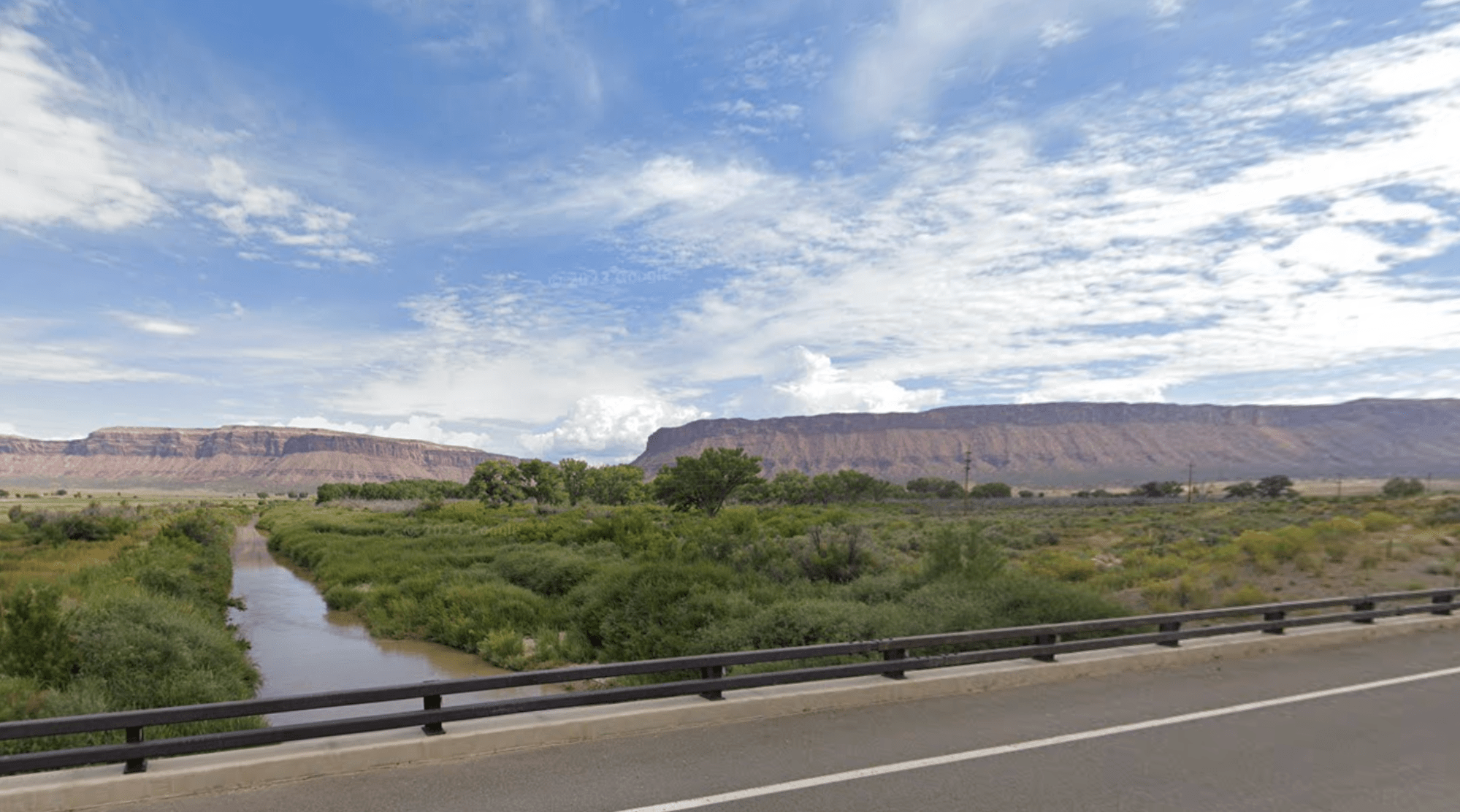
The junipers stop about halfway down at the valley’s lowest point – maybe 20 or 30 miles away – and there the desert yields to a stretch of cultivated green fields and the brown pasture of ranchland for another 30 miles beyond. There, very abruptly, a red mesa rises in a steep and unforgiving slope, banded around the top with a newer layer of rough sedimentary rock not yet given way to the erosion of time. Across the top, it spreads level into its namesake plateau.
The Spanish named a lot of things after food and food-related items – ‘mesa’ simply means ‘table’, for the flat-top mountains of the Southwest resembled tables, presumably where they’d sprinkle the white salt from the mountaintops they saw further west.

Partway along, the mesa is cut in half by a river flowing perpendicular to the valley. This is the Dolores River, a tributary of the mighty Colorado River, which carves the Grand Canyon. The Dolores cuts a trail of its own canyons as it meanders from its source in the Rockies down and back up to the Colorado near Dewey, Utah, north of Moab.
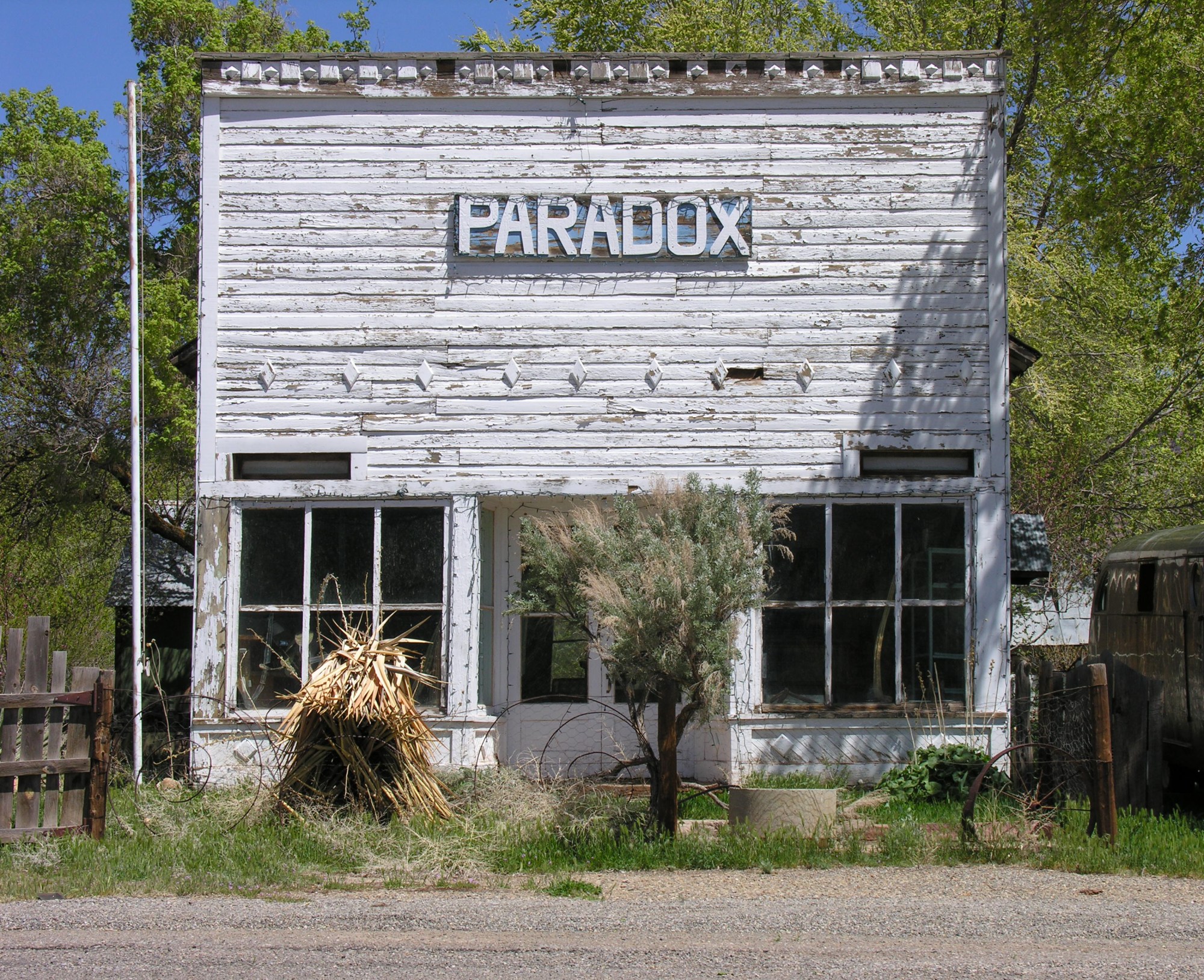
This strange direction of flow – with the river cutting northward straight through the mesa’s rock and stone rather than down the length of the valley – led geologist A.C. Peale to dub this ‘Paradox Valley’ when he was surveying it for the US Geological Survey in 1875.
The Dolores has a mind of her own. She winds southwest from the San Juan Mountains before cutting north for hundreds of miles and then diving west towards the Colorado on her quest to become one with the Grand Canyon. Her name, ‘Dolores’, meaning ‘sorrows’ in Spanish, is heavily associated with the Virgin Mary – Nuestra Señora de los Dolores, Our Lady of Sorrows, one of Mary’s many titles.
All this land was the homeland of the Ute people, and before them the Ancestral Puebloans – forebears of the Pueblo peoples of New Mexico today. Even before them, the Dolores flowed through these lands to take a different route – her ancestral waters would have carved south toward the Four Corners, eventually joining the San Juan River, which heads west across southern Utah. But 70 million years ago, Sleeping Ute Mountain was pushed up into existence by underground volcanic flows, forming a peak that the Utes thought to be a great warrior god who’d fallen asleep while tending his wounds after battle.
The Dolores would have to find a new route, and she did, winding northwards and creating the anomaly of Paradox Valley.
Then, in 1898, while miners were prospecting for gold in the area, they uncovered instead a bright yellow mineral known as carnotite. A sample was sent to Marie Curie all the way over in France for testing and it was found to contain radium and uranium. For decades after, Paradox and the surrounding area experienced a long ‘yellowcake boom’. Towns up the road, Nucla and Naturita, had saloons full of uranium prospectors, a Uranium Drive-In, and Radium Theater. This lasted all the way until the 1980s, when disasters like Chernobyl halted nuclear construction and the whole valley fell into a quiet, glowing slumber.
Today, Nucla and Naturita are outpost towns that still almost seem in the grip of their mining heritage, still very much the Wild West, but grasping for threads at a new life. In 2021, they became a twinned International Dark Sky Community – an ironic swing from providing the world with uranium for cheap energy to conserving energy and preventing the damaging effects of too much light.
I got back into the car and slowly followed the switchbacking road down into the valley, crossing the Dolores quietly at a small bridge halfway across. Here, she was a brown waterway no more than 15 feet across, whose silent flow devoid of white, splashing foam belied a depth underneath the surface. She didn’t look big enough to have carved such a giant slice out of the towering plateau cliffs that fold in on either side, and yet she has. Like all of the strongest women, the Dolores is underestimated, changeable, meandering, paradoxical.
At the eastern end of the valley, I stopped the car one last time, parking up on the shoulder near the top of a crest and listening for the steady pshhhh of car tires along asphalt. There were no cars; no pshhh of tires, no sounds at all except the wind slowly eroding sandstone off of mesa walls. And somewhere behind me, the Dolores River keeping a silent, steady course.

Leave a comment